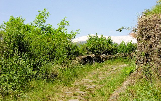
The “Sentiero del Viandante” is an old mule track dating back to the Roman period running along the eastern coast of Lake Como, along the first slopes of the mountains. The path’s triumph is the skilled balance between human activity and nature. It includes built-up areas with rustic stone dwellings, the ruins of old mills, castles, numerous chapels and small mountain churches and terraces cultivated with vineyards and olive groves. This old route connecting local towns and valleys is marked with orange road signs.
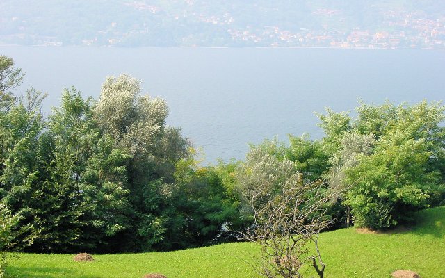
Many hiking enthusiasts walk along it in stages, savouring moments to get away, surrounded by an environment with beautiful scenery where the lake and sky meet.
The path starts in Abbadia Lariana at the small Church of St. Martin and ends at the Sanctuary of the Madonna of Val Pozzo in the district of Piantedo.
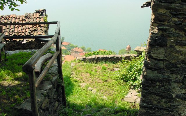
The Esino Valley and its three towns of Varenna, Perledo and Esino are the first stretch of the itinerary proposed here, and are crossed by the Esino Stream and dominated by Mount S. Defendente. The upper alternative route to the path ascends the valley.
Starting in Varenna, there is a rapid climb before the cemetery leading to the town of Perledo, and to the small inhabited village of Vezio and its well-known castle. The builtup area of Ortanella is reached by entering the woods and passing by Mount Foppe. This small hamlet in the district of Esino is surrounded by mountainous nature. Following the vehicular road from the meadows of Ortanella leads to the town of Esino, the mountain community also called the Pearl of the Grigne.
However, this is not the only alternative offered by the “Sentiero del Viandante”. In fact, following the classic alternative route running along the lake leads to the built-up area of Vezio, where a section of the town of Perledo and its characteristic hamlets can be crossed (first Regolo, then Gittana and Cestaglia), and reaches the town of Bellano.
From the piazza in Vezio, hikers descend towards the ravine of the Esino Stream, crossed by a charming stone bridge. Leaving the old mill on the right, they climb towards the industrial area of Campallo. From here they head towards Regolo and come upon a small church belonging to the group of Mariani Sanctuaries. Once in the centre of the hamlet, they continue on the vehicular road leading to the hamlet of Gittana.
At the Maglia chapel, they resume hiking on the pavement, descend onto a mule track (where the marvellous parish church is on the right) and cross the old town centre of Gittana. They start ascending again, cross a small wooden bridge over the Masna Stream and leave the hamlet of Cestaglia above to head in the direction of Bellano.
Once over the bridge in the small Biosio Valley, hikers descend towards the mouth of the Pioverna River, home to Bellano; once past the small chapel of Our Lady of Sorrows, they cross a small bridge over the well-known Orrido ravine.
A steep mule track ascends to the hamlet of Ombriaco, past the Church of St. Bernardino and up towards the Sanctuary of Lezzeno offering a scenic terrace.
This is where the descent starts down into the woods towards the hamlets of Pendaglio and Oro, followed by the dirt road around the town continuing on towards the hamlet of Verginate and its pretty views of the lake.
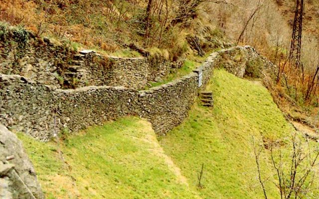
Large steps dug out by the RomansThe mule track continues along the bridge crossing the Granda Valley and arrives at the Ronchi dwellings and then the Chignolo farmhouses in the district of Dervio. The itinerary continues just above the railway line on the old trunk road leading to Villa di Dervio and its old church of St. Quirico with a pretty bell tower in Romanesque style, and crosses the Varrone River on the bridge which was a stronghold until 1389. Continuing on the right is the Lavine spring on the vehicular road to Valvarrone Valley. A steep mule track with stairs then leads to the built-up area of the castle with its medieval tower and the small Church of St. Leonard.
Once out of the built-up area, the provincial road leads down to the roundabout, and then straight on the road heading towards Corenno Plinio. The itinerary crosses the towns of Chiari and Monastero and arrives at the country complex constituting the Monastery of St. Clemente degli Umiliati.
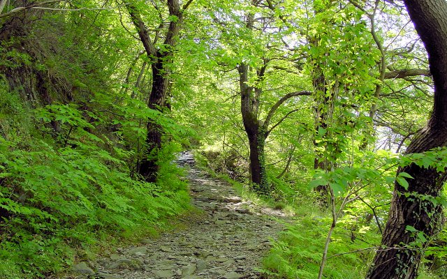
Past the duct, the path resumes its conformation of old cobblestone mule track (eroded in the rock at times) and descends among low walls while offering a marvellous vision of the medieval village of Corenno Plinio, its majestic castle and the Church of St. Thomas of Canterbury.
The itinerary continues on the provincial road located in the old moat of the Corenno Castle and then continues on the mule track on the right, crossing fields and farmhouses and arriving in the district of Dorio. Hikers arrive (on a slight slope) in Torchiedo and then Panico, where they walk beside the Church of St. George – Dorio’s old parish church.
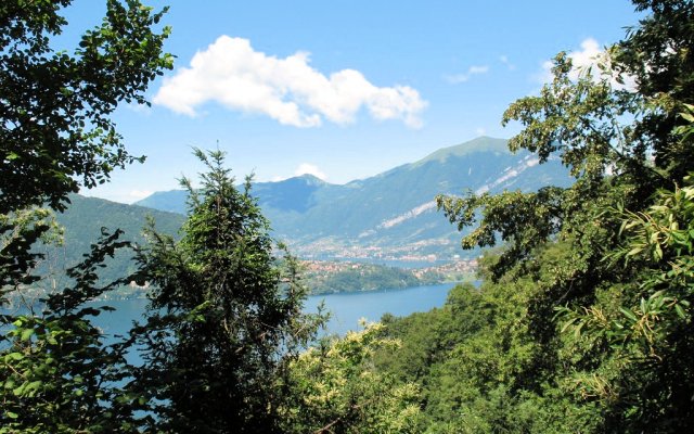
The path then climbs to Mandonico, a characteristic group of abandoned dwellings in local unhewn stone. Next the mule track cuts across towards the coast and reaches the small Church of St. Rocco located on a headland and offering a scenic glimpse of the lake and the peninsula of Piona.
The path turns northeast with the small lake and Piona Abbey in sight while circumventing the spurs of Mount Legnoncino. Through the woods is Mount Perdonasco, and once past Noh Valley, hikers arrive at Mount Sparesee. There is an unpaved stretch here in a woody area, which connects with a cartroad whose tight turns descend down to Posallo di Colico.